
New Braunfels ZIP Code Coverage
The regional Comal County table gives a working set of five postal classifications associated with the New Braunfels area. It is not a list of city neighborhoods or a resident count. USPS decides delivery assignment one address at a time, and the City warns that a New Braunfels mailing city can also serve unincorporated Comal County, Guadalupe County, or ETJ territory. Use each row as a geographic starting point, then verify the actual address.
| ZIP | Regional area and acceptable city | Postal classification | New Braunfels research note |
|---|---|---|---|
| 78130 | New Braunfels; Canyon Lake is listed as acceptable city | Standard | Mailing geography can extend outside the legal city limit. |
| 78132 | New Braunfels; Canyon Lake is listed as acceptable city | Standard | Acceptable-city wording does not settle municipal jurisdiction. |
| 78131 | New Braunfels | PO Box | Do not treat as a street-delivery or parcel-residence area. |
| 78135 | New Braunfels | Unique | The regional assessment gives the classification; institution detail was not located. |
| 78133 | Canyon Lake; New Braunfels is listed as acceptable city | Standard | A Canyon Lake delivery geography can display New Braunfels as acceptable city. |
The city-published 2024 benchmark uses 78130, 78131, 78132, and 78135 as its analytical New Braunfels ZIP scope. The regional table also brings in 78133 and its acceptable-city note. Both statements can be true because they serve different purposes. Neither replaces the result from a street-and-unit lookup.
New Braunfels Standard and Special ZIP Codes
Standard, PO Box, and unique are postal classifications, not types of city residency. The key local distinction is 78131. It is a New Braunfels PO Box ZIP, so correspondence can be local without identifying a deliverable street or parcel. A PO Box is not a parcel. Keep it separate from a situs address, which is the location tied to an appraisal or GIS record.
78135 is classified as unique in the regional assessment, but the exact institution or delivery detail was not located in the research. It should therefore be labeled only as a unique ZIP, not assigned a purpose by guesswork. Likewise, 78133 should retain its Canyon Lake standard classification alongside the New Braunfels acceptable-city label.
Postal caution. A New Braunfels ZIP code can identify mail routing without proving city residence, street delivery, parcel ownership, or a person’s current location.
Postal ZIPs and New Braunfels Limits
USPS assigns the mailing city through the delivering post office, not through the municipal boundary. That is why a New Braunfels label can occur in unincorporated Comal County, Guadalupe County, or the city’s extraterritorial jurisdiction. County is a record-custodian decision, city limit is a legal-municipality decision, and ZIP is a delivery decision. They should never be merged into one field.
Use the USPS ZIP lookup with the street, city, state, and unit when applicable. USPS notes that its result does not confirm a person or company at the address. ZIP assignments can change, and the research advises retaining the returned ZIP, ZIP+4 if present, normalized street, and lookup date.
Note: A ZIP-based result near the New Braunfels edge may require the same records check in both Comal and Guadalupe County.
New Braunfels GIS ZIP Boundary Layers
The City OpenData AddressesBoundaries service has separate Addresses, CityBoundaries, Counties, Parcels, ParcelsOutsideETJ, VoterPrecincts, Subdivisions, and Zipcodes layers. It can use query, identify, find, and spatial filters. That separation is unusually helpful: it forces a searcher to check which kind of boundary a result represents instead of treating every map shape as a city line.
The City GIS boundary service provides the ZIP and jurisdiction layers for this cross-check.
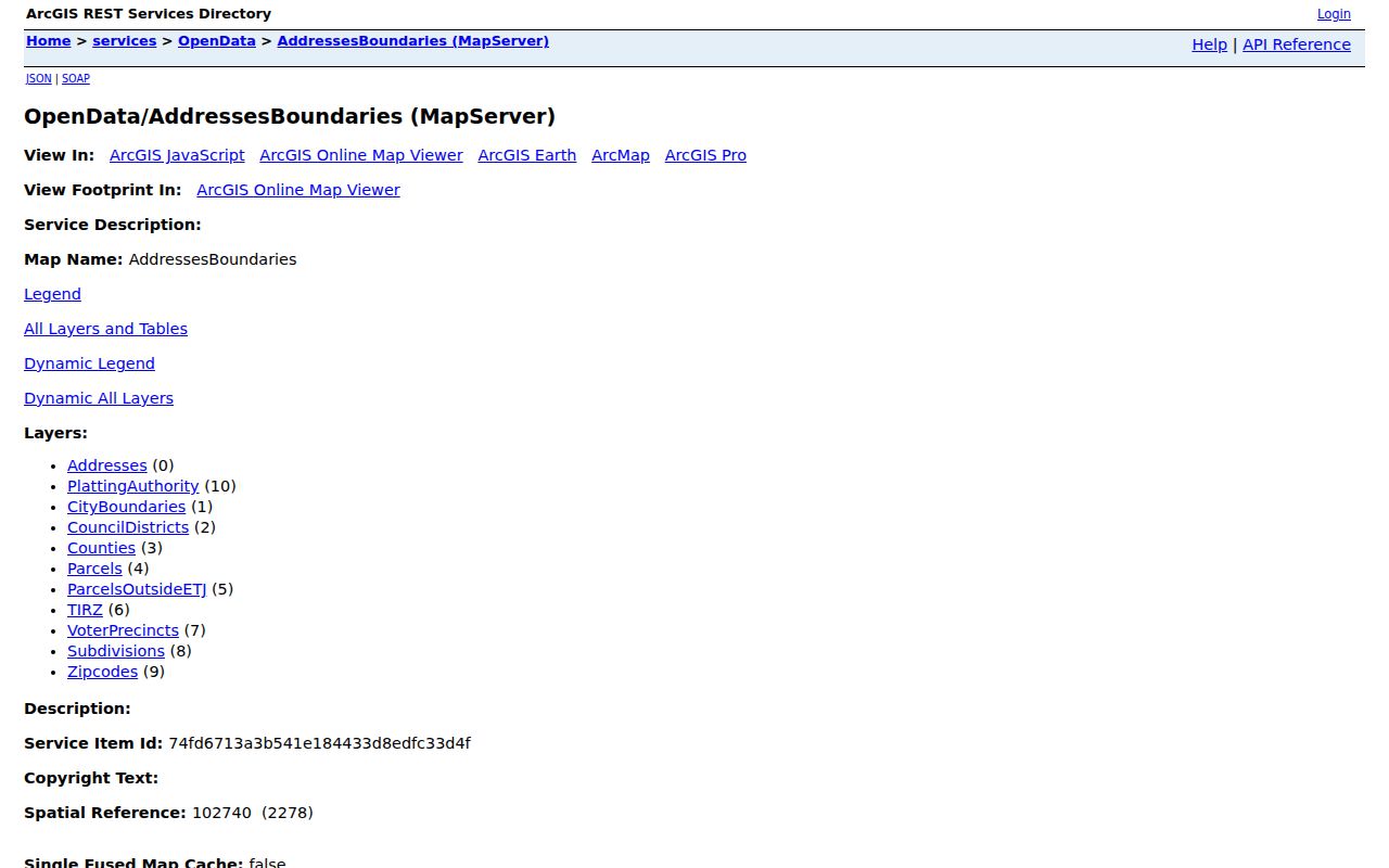
The GIS polygon is a map cross-check, not the USPS delivery database. Capture the returned address point, parcel ID, county, city-boundary status, and ZIP polygon, then compare them with USPS and the appropriate county record source.
Narrow a New Braunfels ZIP Code Search
A ZIP search can narrow geography, but it cannot establish an occupant. Start with the address itself, then move from postal validation to the city boundary and parcel record. The Comal Appraisal District may be searched by owner, address, property ID, legal/subdivision details, and advanced fields. Its GIS-related parcel fields include situs ZIP, but that is property data, not a ZIP-wide roll of residents.
- Validate the full street address and unit through USPS, preserving the returned ZIP and ZIP+4 where supplied.
- Check the point in City GIS against Zipcodes, CityBoundaries, Counties, and ParcelsOutsideETJ.
- Use CAD for the matched parcel, retaining the situs, property identifier, legal description, and tax-owner context.
- Route any voter or court request to its separate custodian and apply the legal limits that control that record type.
Once a ZIP has been narrowed to an actual street, the New Braunfels Street Directory follows the address, parcel, and deed path in more detail. Use it to examine one street or parcel, not to make a ZIP itself stand in for a household.
New Braunfels ZIP Code Parcel Fields
Comal CAD’s Advanced search and the City parcel schema provide useful ways to cross-check an address after a ZIP lookup. The CAD form includes Owner Name, Street Number, Street Name, Property ID, Geographic ID, Subdivision, Tax Year, and other fields. Its owner-name convention is “Last Name First Name.” For street name, the research advises omitting prefix, suffix, and unit. Use the property or geographic identifier when a common street or name returns more than one record.
| Field or layer | What it narrows | How to read it |
|---|---|---|
| Street Number and Street Name | Address search in CAD | Search the street form directed by CAD; keep unit data separate where present. |
| Property ID or Geographic ID | Specific assessed parcel | Use as a stable cross-check before changing to legal-description research. |
| Situs_Zip | Parcel’s recorded situs ZIP | Compare with USPS rather than assuming the fields will always agree. |
| Zipcodes and Counties layers | Map polygon and jurisdiction | Use the City GIS result to decide whether a county or city route applies. |
| Subdivision, Block, and Lot | Legal place within a recorded plat | Verify against the county plat and deed when legal identity matters. |
A CAD owner field may belong to a trust, entity, estate, tax representative, or out-of-area mailing address. It should not be recast as a current resident field. This separation keeps postal, parcel, and personal claims distinct.
New Braunfels ZIP Code Map Checks
The New Braunfels maps index links interactive, PDF, general-reference, flood, historic-district, subdivision, and permit maps. After a GIS query, a general-reference or city-limits map can serve as a human-readable check. It cannot replace the address-level USPS result or the county’s parcel record.
For a map-based conclusion, retain the layer name, map date, source URL, and whether it depicts a ZIP polygon, city boundary, county, ETJ, or Census geography. Keep the query date as well. The label is part of the evidence.
New Braunfels ZIP Codes and ZCTAs
A Census ZIP Code Tabulation Area, or ZCTA, is a statistical approximation of USPS ZIP areas. It is useful for population context but is not a postal-delivery count and does not identify named residents. The Census profile for 78130 showed a population figure in the inspected view, but that number describes a dated statistical area, not the number of people served by a particular post office.
The distinction matters in New Braunfels because the City benchmark and the regional postal table use overlapping, but not identical, ZIP sets. The benchmark’s four-ZIP analytical scope is designed for economic comparison. The regional list reflects postal classifications and acceptable-city labels, including 78133. Neither source claims to redraw delivery routes. A ZCTA should therefore be labeled with its Census source and date instead of being presented as a USPS boundary.
The research did not submit a current USPS city-and-state result for every area ZIP. That is a useful limitation to preserve: the documented table is a working reference, while USPS remains authoritative for a particular street and unit. Use a ZCTA only when the question is statistical. Use USPS for delivery assignment, City GIS for local boundary comparison, CAD for parcel context, and the county custodian for the specific record type.
New Braunfels ZIP Code Boundary Rules
Five fields answer five different questions in the New Braunfels area: USPS mailing city and ZIP, legal municipality, county, ETJ or limited-purpose status, and Census ZCTA. A sound postal record keeps each field visible. That practice prevents a mail label from being mistaken for city residency and helps route deeds, courts, elections, and public-information requests to the right custodian.
- ZIP and ZIP+4
- The five-digit ZIP identifies a broad postal area. ZIP+4 adds delivery-route detail and does not establish ownership or occupancy.
- PO Box ZIP
- A ZIP used for post-office boxes. It can be locally associated without giving a deliverable street or parcel location.
- Unique ZIP
- A ZIP classification associated with a single delivery arrangement. The regional table labels 78135 unique but does not identify its exact arrangement.
- Carrier route
- A postal delivery grouping within a ZIP. It is a routing concept, not a municipal boundary or a resident list.
Note: When postal and map data disagree, retain both results with dates rather than forcing one label to replace the other.