
Trace a New Braunfels Street by Address
Begin with the address as a location, not as proof of a household. USPS can normalize the mailing form and unit. City GIS can then place that point against the parcel, county, city-boundary, ETJ, ZIP, subdivision, and precinct layers. For a parcel in Comal County, Comal Appraisal District supplies the owner or tax-account relationship, situs, and parcel identifiers. The County Clerk’s ROAM index connects those identifiers to recorded instruments. Each step answers a narrower question, which keeps a street directory result from turning a tax record into an unsupported claim about who lives there.
- Use USPS ZIP Lookup to standardize the street, city, state, and unit. Its result confirms a postal format, not a person or company at the address.
- Search the New Braunfels GIS AddressesBoundaries service for the address point, parcel, county, city-limit, ETJ, and ZIP context.
- Use the parcel ID, geographic ID, street number, or street name in Comal Appraisal District Property Search to identify the assessment owner and situs record.
- Search Comal ROAM by party, legal description, instrument number, or date range. Record the document number, date, and legal description before reading a deed image.
- For a lawful, dated election-record question, use the official request route and honor every protected address. For earlier address associations, use archive-held telephone and criss-cross directories rather than treating either source as a current roster.
New Braunfels reaches Comal and Guadalupe County records environments. A New Braunfels mailing label alone does not settle that first jurisdiction question, so repeat the property and records search in the proper county when GIS shows an edge-area parcel.
Normalize a New Braunfels Street Address
USPS offers address, city-and-state, and ZIP routes. The address form requires street, city, and state, while company, unit, and ZIP are optional. Add the apartment or suite when it is known. A unit can distinguish several records that share one street number. Keep the returned form and lookup date with the research notes because postal assignments can change.
Postal geography is not municipal geography. The City’s New to NB reference explains that a delivering post office assigns the mailing city. A New Braunfels address can be in unincorporated Comal County, Guadalupe County, or the ETJ, and NBU service does not establish city residency. For a street directory, retain separate fields for USPS city and ZIP, county, and legal city or ETJ status.
Note: Search street suffixes, directions, unit forms, and historic variants separately, then preserve the source spelling instead of silently combining unlike addresses.
Comal CAD Along New Braunfels Streets
Comal Appraisal District Property Search has By Owner, ARB Search, and Advanced tabs. Its owner field uses the convention Last Name First Name. For a named street, the Street Name field is useful, but the form advises leaving out the prefix, suffix, and unit. A result can then be checked with Property ID or Geographic ID before changing to legal-description research. CAD reports that it updates each business day, but the inspected sources did not establish a complete historical retention range.
| CAD field | Control | Use on a street search | Format or limit |
|---|---|---|---|
| Owner Name | Text | Find an assessment owner | Last Name First Name |
| Street Number | Text | Match the situs number | Number portion only |
| Street Name | Text | Browse one street | No prefix, suffix, or unit |
| Property ID | Text | Return a CAD property record | CAD identifier |
| Geographic ID | Text | Cross-check parcel identity | Geographic parcel identifier |
| Subdivision | Autocomplete | Narrow a platted area | Select a returned value |
| Abstract | Autocomplete | Narrow an abstract area | Select a returned value |
| Condo | Autocomplete | Distinguish condominium records | Select a returned value |
| Neighborhood | Autocomplete | Narrow a CAD neighborhood | Select a returned value |
| Property Type | Dropdown | Apply a property category | Options were not exposed |
| Tax Year | Dropdown | Choose a tax-year context | Available years were not exposed |
| Doing Business As | Text | Search a business tax name | Not a household field |
The City parcel-field service shows the sort of public parcel data that makes a CAD result easier to check.
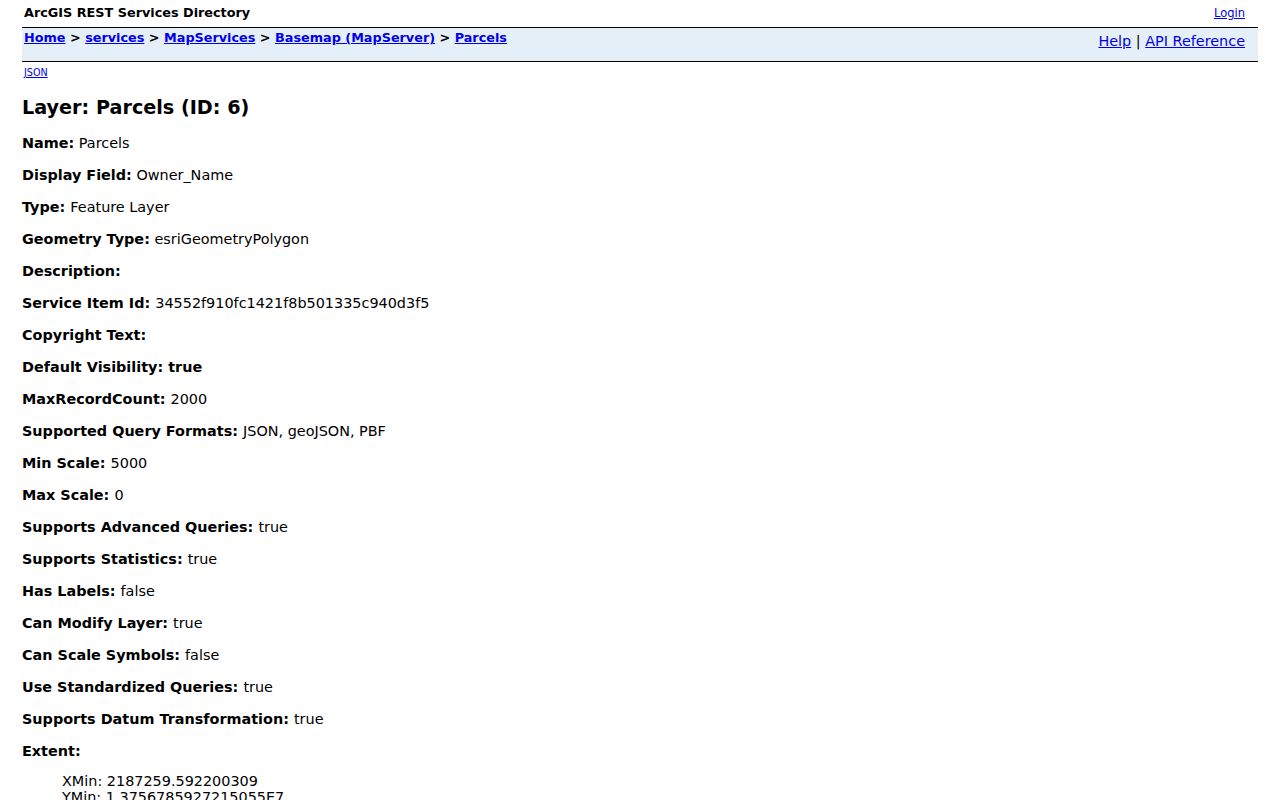
Parcel fields include owner-name and mailing classes, situs and unit fields, property and geographic IDs, subdivision, block, lot, legal description, deed references, tax year, values, and geometry. The field list is a record schema, not proof that one person occupies a parcel.
New Braunfels Address Records by Source
A street-by-street search changes as the question changes. GIS locates the address and its jurisdiction. CAD identifies an assessment relationship. ROAM records instruments and parties. A plat supplies block and lot context. Permit, historical-directory, and voter materials each have narrower purposes and dates. The table keeps those purposes apart.
| Address record | Local keeper | What it can show | Access path |
|---|---|---|---|
| Postal lookup | USPS | Standardized mailing address and ZIP | Online lookup, not occupancy proof |
| Address and parcel layers | New Braunfels GIS | Address point, parcel, county, city or ETJ, ZIP, precinct | REST query, find, or identify |
| Appraisal parcel card | Comal CAD | Owner or tax account, situs, IDs, values, subdivision fields | Free online search |
| Official-record index | Comal County Clerk / ROAM | Grantor, grantee, instrument, date, legal description | Online index, Clerk request fallback |
| Recorded plat | County Clerk | Subdivision, phase, block, lot, replat, easements | Plat Viewer download or certified copy |
| Building permit | City Development Services | Permit type, address, applicant or contractor, submitted date | Public search; documents may need login |
| Historic directory | Sophienburg and UT collections | Dated address, telephone, household, or business association | Archive or catalog access |
A parcel number may connect a GIS point to CAD and then to the legal description used in ROAM. It does not connect a street to a universal resident list. When a record is unavailable online, the County Clerk’s written research form accepts document number, volume and page, document type, dates, party names, and legal description. The form asks for a focused request, not a sweep of every record about a person.
Map New Braunfels Streets Through GIS
The AddressesBoundaries service lists Addresses, CityBoundaries, Counties, Parcels, ParcelsOutsideETJ, Subdivisions, VoterPrecincts, and Zipcodes. It supports find, query, identify-style operations, geometry filters, ordering, pagination, and GeoJSON responses. Start with an address point, capture the parcel ID and county or boundary result, then compare parcel attributes with CAD and ROAM. Geometry establishes a spatial relationship, not legal title or a current household.
The City’s map index also gathers interactive, reference, historic-district, flood, subdivision, and permit maps for a human-readable cross-check.
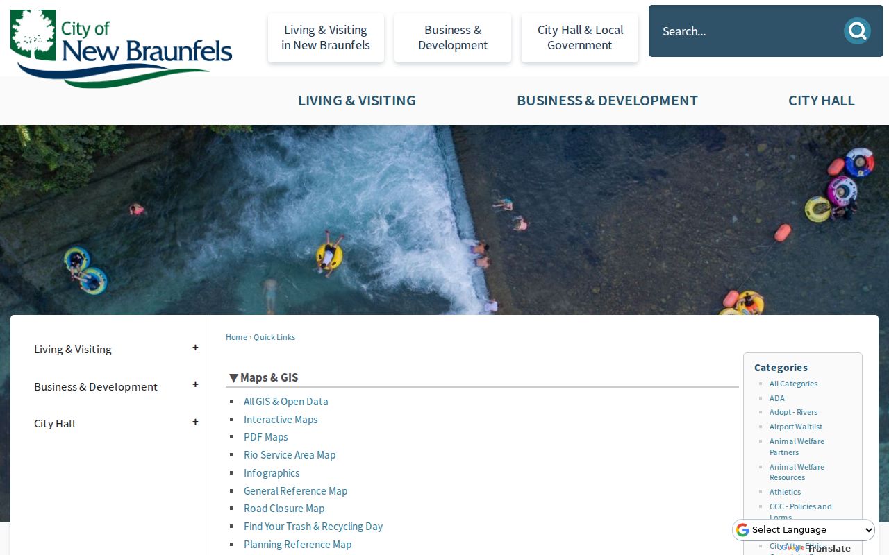
Use the General Reference Map after the REST lookup to check the result in local context. The exact interactive click sequence was not documented in the inspected official material, so a street directory should report the layer and source date rather than claim a particular map control was used.
Read a New Braunfels Parcel and Plat
A Comal County Plat Viewer search adds the recorded layout behind an address. It can show subdivision name, phase, block, lot, revisions, easements, and reserve tracts. Downloads are unofficial. For a legal conclusion, obtain a certified copy through the County Clerk and use the recorded revision, because a replat can change the lot numbering shown in older records.
- Parcel
- A mapped property unit used for assessment and geographic reference. One parcel can have more than one address or unit.
- Situs address
- The property’s location address, which can differ from the owner’s mailing address.
- Plat
- A recorded map that lays out subdivision, block, lot, easement, and tract details.
- Criss-cross directory
- A historical reverse directory organized by address, useful for a dated household or business association.
Parcel, GIS, and plat records answer different questions. A street directory should keep the street address, situs, mailing address, legal description, and map source in separate columns rather than treating them as interchangeable.
ROAM Chains on a New Braunfels Street
Comal ROAM is the County Clerk’s official-record starting point for deeds, liens and judgments, military discharges, assumed names, maps and plats, and related local records. It supports full name, business name, instrument number, date range, designated status, and legal-description searching. Use both grantor and grantee concepts where the search permits. Preserve the document number, document type, recording date, volume or page reference, legal description, and image route.
The ROAM coverage label reads “Sovereignty–Present,” while the exact modern portal cutoff was not located. The State Library’s Comal guide lists deed records for 1846–1901 and direct and reverse deed indexes for 1846–1895, so an older street chain may require microfilm or interlibrary loan even when the online index is useful.
A watermarked preview is free, and the portal’s subscription notes list official images at $1 per page. If an image, plat certification, or focused record search cannot be completed online, the Clerk’s request form says one to three documents may take up to 24 hours and three or more may take up to 48 hours.
Permit Trails Along New Braunfels Streets
The public New Braunfels permit search can tie a project record to an address and submitted-date range. It is useful for dated construction or alteration context. It does not establish title or a current occupant, and project documents may use ProjectDox or another login route. The inspected public form did not establish a historical start date, result layout, status display, inspection timeline, or document-link placement.
| Permit search field | Recorded use |
|---|---|
| Permit Number | Text search; exact or partial behavior was not located |
| Permit Type | Optional dropdown; options were not exposed |
| Applicant Name | Optional person or business applicant field |
| Contractor Name and Type | Optional contractor fields; type options were not exposed |
| Permit Address | Street or address search; city says active permits can be searched by address or general location |
| Date Submitted, From and To | Optional date range; exact date format was not located |
Compare a permit address with the parcel situs and its source date. An applicant or contractor can be associated with a project without being the owner or resident.
New Braunfels Street History as Evidence
Historic street work needs a timeline, not a quick match. Sophienburg holds local directories, telephone books, newspapers, and genealogies, with research by appointment. The city’s historic file for 794 W. Mill models the method: a 1923 telephone-directory listing and 1931 city-directory listing connect Theodore and Margarete Schwab to the address, then the file compares a 1900 plat with 1901 and 1902 ownership transactions. The first Sanborn coverage noted there is 1922. Each association belongs to its source and year.
Sanborn research can add building use, materials, lot context, and street changes for the 1907, 1912, 1922, 1930, 1949, and 1969 New Braunfels map years identified in local reports. It is not ownership evidence. When the question becomes a past household rather than a current street record, the New Braunfels Directory Book has the collection-focused path.
Note: The 794 W. Mill sequence is a local evidence model, not permission to combine records from different years into one current-person conclusion.
Limits on a New Braunfels Street Directory
A New Braunfels street directory can show dated and source-specific associations, not an assured list of every person at every address. A CAD owner can be an entity, trust, estate, tax representative, or out-of-area mailing contact. GIS parcels can lag deeds. A public voter record can be protected or use a substitute address, and a protected address must not be reconstructed through other sources. Court, permit, and meeting records are also purpose-specific, not residency proof.
Texas Election Code restrictions apply to voter-list use, and the Secretary of State’s address-confidentiality guidance describes categories whose addresses may be suppressed. Report the narrow fact a record supports, retain the source date, and leave a conflict unresolved when the sources do not agree.
Lawful use. Use New Braunfels street records for focused, personal, and lawful research. Do not use public address information to stalk, harass, intimidate, or target anyone.